One of Burien’s outdoor gems is the “Indian Trail”.
This wandering, varied trail winds high above the shoreline strip of SW 172nd St. – the “Sunrise Trail” – and then, from Three Tree Point northward, parallels Maplewild Ave. SW – the “Sunset Trail”. It is said to be the remnant of a trail used long ago by the local Native American tribes as they traveled from the south end of Puget Sound to the north. Some portions of the trail are heavily-wooded and lush green. Other areas are wide open to the sky. There are three public beach access points along the way.
On Sunday, July 7, our monthly Walk-n-Talk starts cliff-high, winds down to Three Tree Point, then back up to Maplewild, at the 16000 block. At one point along the way, there is a 180 degree view of Normandy Park, Des Moines, Redondo, Mt. Rainier, Tacoma, the islands of Puget Sound and the Olympic Mountains.
This is a FREE event and open to all (that can handle the terrain of the trail), including friendly four-legged friends.

Mt. Rainier, as see from the “Sunrise” portion of the Indian Trail.
- Date: Sunday, July 7, 2019 (If it’s a hot day, a water bottle is a great idea on this trail.)
- Time: 2:00 meet-up. Walking starts at 2:15
- Place: Meet at the corner of SW 167th Place and 31st Ave. SW (NOT at Burien Town Square.)
This is in the Gregory Heights neighborhood above Three Tree Point. - Route & Distance: We start UP in Gregory Heights, go DOWN to Three Tree Point, UP partway on Maplewild, then turn around and go back down to the Point and back up to Gregory heights. The total is about 3 miles, round trip. The elevation change is about 300 feet.
- Parking: There is parking on the street in the Gregory Heights neighborhood, near the starting point. (Public parking along Maplewild is difficult to find.) As always, please be respectful of private property when parking your car.
- NOTE – Trail Terrain: This is a beautiful walk, paved wide in places, a narrow dirt path in others. Please be advised that this trip has quite an elevation change going down the hill and then back up. The path is also quite rugged and irregular. Because of these factors, it’s a poor choice for those with health and mobility limitations, and the trail will not accommodate strollers for children.
As with all of our walks, walkers may choose to do all or just part of the route. And walkers may always walk at whatever pace is most comfortable for them.
If you do not want to walk back up the hill to the starting point, but would rather finish at the Maplewild end, we suggest that you carpool with a friend, leave the first car somewhere along Maplewild (or within walking distance), and then drive the second car to the starting point. At the end of the walk, you can hop into the first car and go back and get the second car.
For further information, please contact Maureen Hoffmann at info@wabiburien.org

The sweeping view, in evening along the “Sunrise” portion of the Indian Trail. (click the photo for a larger view.)
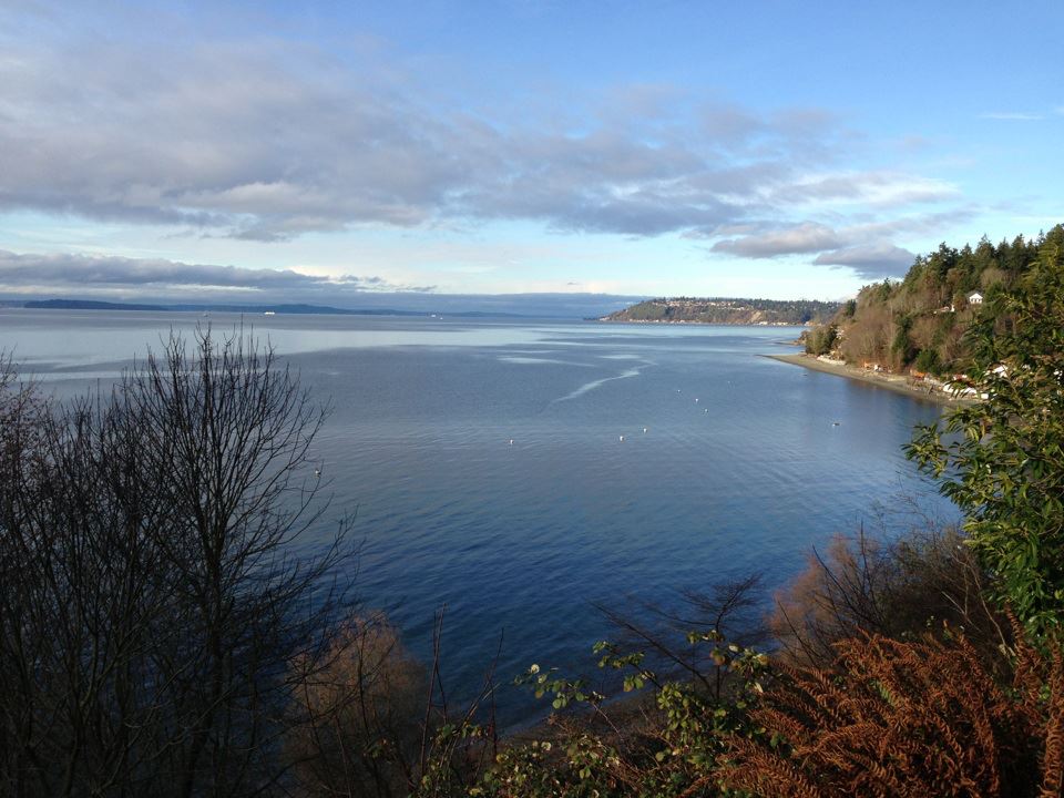
When standing on the “Sunset” part of the Indian Trail, which parallels Maplewild, one can look northwest toward Seahurst Beach, Shorewood and beyond, toward West Seattle.